Lumen Re: flood extent the morning after a storm
Lumen's claims team receives a flood extent map before the water has gone down, cloud or not. Radar passes at dawn are delivered about 40 minutes after downlink.
- Customer
- Lumen Re, reinsurance
- Sensor
- X-band radar, 3 m
- Fleet
- 4 satellites
- Delivery
- About 40 min after downlink
- Live since
- June 2022
The problem
After a storm, a reinsurer needs to know which insured assets are under water, and it needs to know in hours, not weeks. Optical satellites cannot see through the storm cloud that causes the flood, and aircraft cannot fly in it.
Lumen used to wait for optical imagery and for loss adjusters. First numbers took six days; the portfolio was already reserved by the time the picture was clear.
The setup
A hazard feed from a weather service triggers a priority order. The next radar passes over the basin are tasked, compared against the last dry-weather image, and cut into a flood mask. Lumen does not review pixels; they review a list of locations.
| Payload | 4 X-band radar satellites (PH-R), dawn and dusk passes |
|---|---|
| Standing orders | Watchlist of 60 river basins and coasts; a hazard feed triggers priority tasking |
| Products | GRD and Change pair, flood masks as GeoJSON, 3 m |
| Delivery | Straight to Lumen's exposure platform, 40 minutes after downlink |
| Exposure match | Flood polygons intersect 2.1 million insured locations automatically |
| Term | 3 years |
What the satellites saw
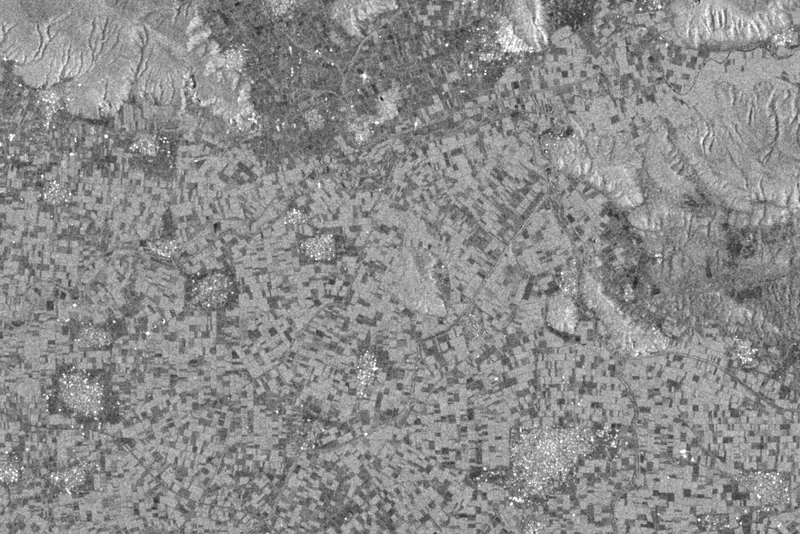
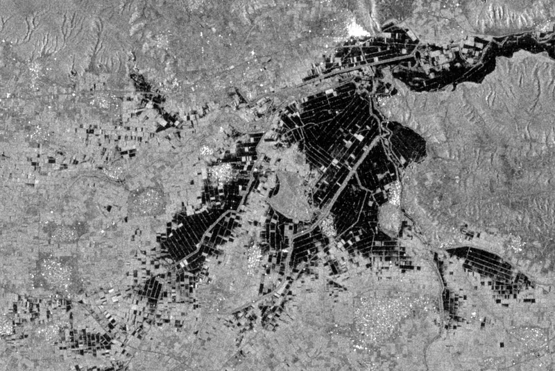
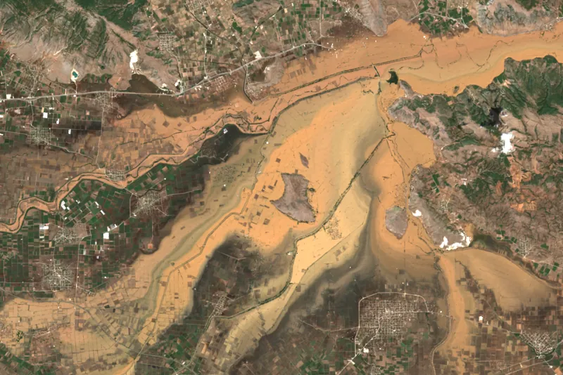
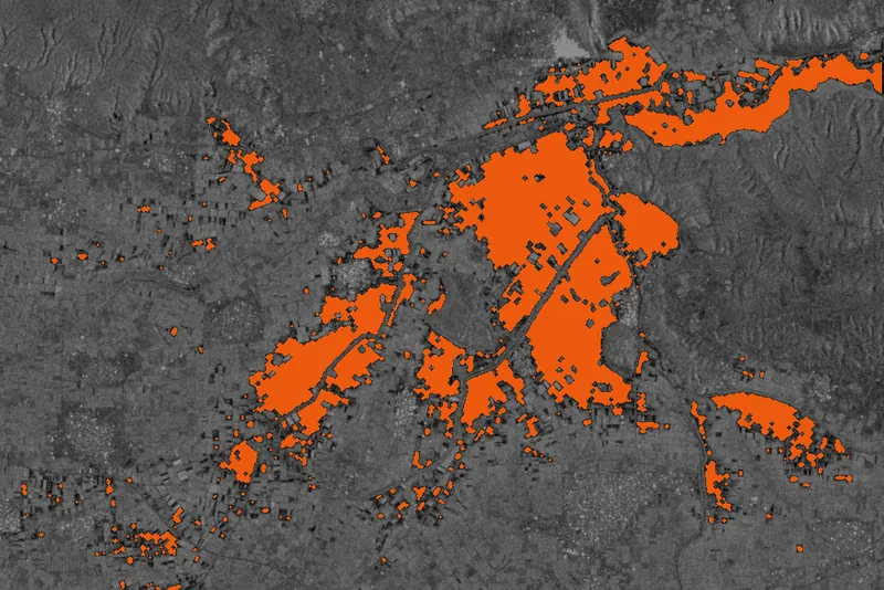
Before: radar, 1 September 2023. Fields and villages as normal. Imagery: Contains modified Copernicus Sentinel data (2023), Sentinel-1 VV and Sentinel-2. Thessaly, Greece, after Storm Daniel. Extent derived by simple thresholding for illustration.
Results
The pair above is the product. The rightmost tab is the same place in natural colour, taken once the cloud had cleared; the water is plain, but it was available days after the radar map.
- First flood map
- 4 h after cloud-free pass
- Flooded area in frame
- 57 km²
- Locations matched
- 2.1 million in 3 min
- Time to first reserve estimate
- 11 h, down from 6 days
| T + 0:00 | Satellite passes over the basin at dawn and images it |
|---|---|
| T + 0:12 | Downlink over Svalbard |
| T + 0:52 | Calibrated radar scene lands in Lumen's bucket |
| T + 1:05 | Flood mask produced against the dry-weather reference |
| T + 1:08 | Mask intersected with the 2.1 million insured locations |
| T + 4:00 | Claims team receives the ranked list of affected policies |
We stopped asking whether we can see the flood. We ask which policies are in it.
Customer, quotes and figures are invented for this concept site.
Could this work for your area?
Send us the region and the question; we will tell you which sensor and fleet size it takes.