Multispectral sensor, 5 m, eight bands
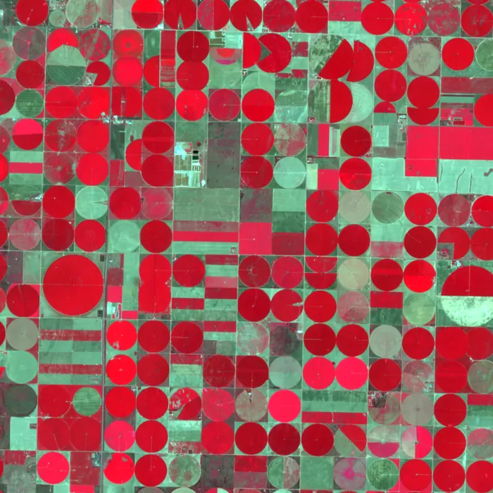
Eight bands from coastal blue to near infrared. Healthy plants turn red in a colour-infrared composite, and stressed fields fade weeks before the eye can tell.
Specification
PH-M payload on the Perihel standard bus, orbit 525 km sun-synchronous.
| Ground sample distance | 5 m |
|---|---|
| Swath width | 45 km |
| Spectral bands | 8: coastal blue 443, blue 490, green 560, red 665, red edge 705, red edge 740, near infrared 842, near infrared 865 nm |
| Band width | 15 to 115 nm, see band table in the datasheet |
| Radiometric resolution | 12 bit |
| Signal to noise | Above 120 at reference radiance |
| Revisit, one satellite | 2 days |
| Co-registration | Band to band better than 0.2 pixel |
| Local overpass time | 10:30 descending |
| Calibration | Solar diffuser and lunar views |
| Downlink | X-band, 800 Mbit/s |
Products and formats
Every scene is delivered as a cloud-optimised GeoTIFF with a STAC item. Levels are cumulative: you can order L1B and reprocess to L2 later.
| Level | Content | Format | Delivery after downlink |
|---|---|---|---|
| L1C | Orthorectified top-of-atmosphere reflectance, all eight bands | COG GeoTIFF | 35 min |
| L2A | Surface reflectance, cloud, shadow and snow mask | COG GeoTIFF | 55 min |
| Indices | NDVI, EVI, NDWI, red-edge chlorophyll index | COG GeoTIFF, int16, scale 0.0001 | 60 min |
| L3 | Weekly cloud-free composites, field-level statistics | COG GeoTIFF, GeoParquet | Within 24 h |
Example products
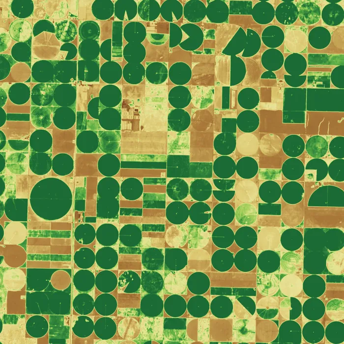
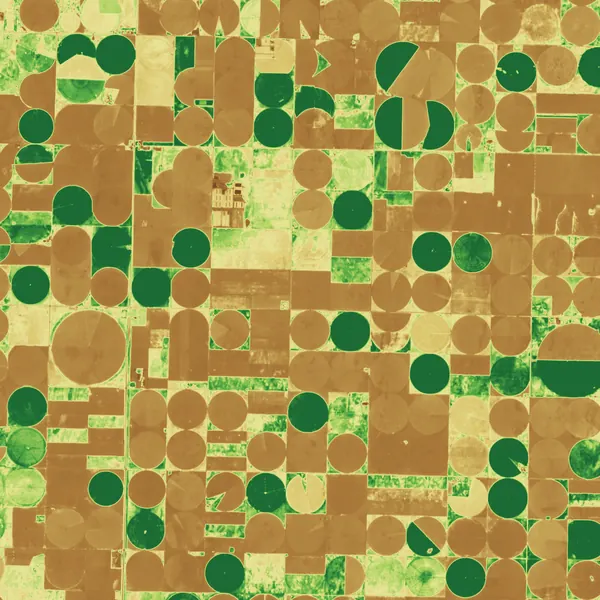
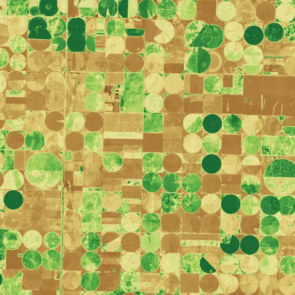
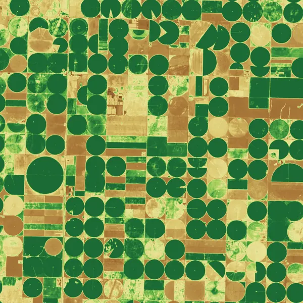
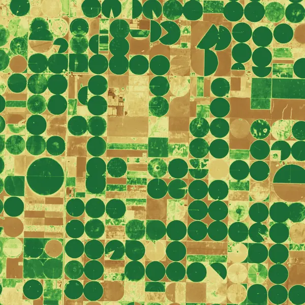
Imagery: Contains modified Copernicus Sentinel data (2025), Sentinel-2, southwest Kansas. Four dates show the crop calendar of the same square: wheat in May, corn through July, harvest in August.
Resolution and revisit
Revisit of a mid-latitude point improves with every satellite you add to the plane. See the coverage page for the ground tracks.
| Satellites | Revisit |
|---|---|
| 1 | 48 h |
| 3 | 16 h |
| 6 | 8 h |
| 12 | 4 h |
Typical uses
- Crop monitoring
- Field-level vigour, emergence and senescence, and yield models fed every two days.
- Forestry
- Clear-cuts, thinning and storm damage found against harvest plans.
- Water quality
- Chlorophyll and turbidity in lakes and coastal water.
- Mining and land cover
- Spectral signatures of exposed rock, tailings and rehabilitation.
Sample delivery
Each scene arrives with a STAC item that any STAC client reads. Query it through our API or find it next to the data in your own bucket.
Delivered item, abbreviated
{
  "type": "Feature",
  "stac_version": "1.0.0",
  "id": "PH-MUL-20250728-173012-0412",
  "collection": "perihel-multispectral-l2a",
  "properties": {
"datetime": "2025-07-28T17:29:31Z",
    "perihel:level": "L2A",
    "gsd": 5,
    "eo:bands": 8,
    "eo:cloud_cover": 0.3,
    "perihel:ndvi_mean": 0.58,
    "proj:epsg": 32614
  },
  "assets": {
    "data": { "href": "s3://your-bucket/perihel/perihel-multispectral-l2a/PH-MUL-20250728-173012-0412.tif",
              "type": "image/tiff; application=geotiff; profile=cloud-optimized" },
    "metadata": { "href": "s3://your-bucket/perihel/perihel-multispectral-l2a/PH-MUL-20250728-173012-0412.json" }
  }
}
Questions about multispectral
The two red-edge bands detect chlorophyll changes about three weeks earlier than red alone, and the coastal-blue band corrects haze and maps shallow water.
Seven of the eight bands are within 15 nm of a Sentinel-2 band, so models trained on Sentinel-2 transfer with a simple harmonisation step we supply.
The L2A mask flags cloud and shadow, and the weekly L3 composite picks the clearest pixel for each field.
Task a multispectral satellite
Tell us the area and the revisit you need. An engineer replies with orbit, sensor and fee.