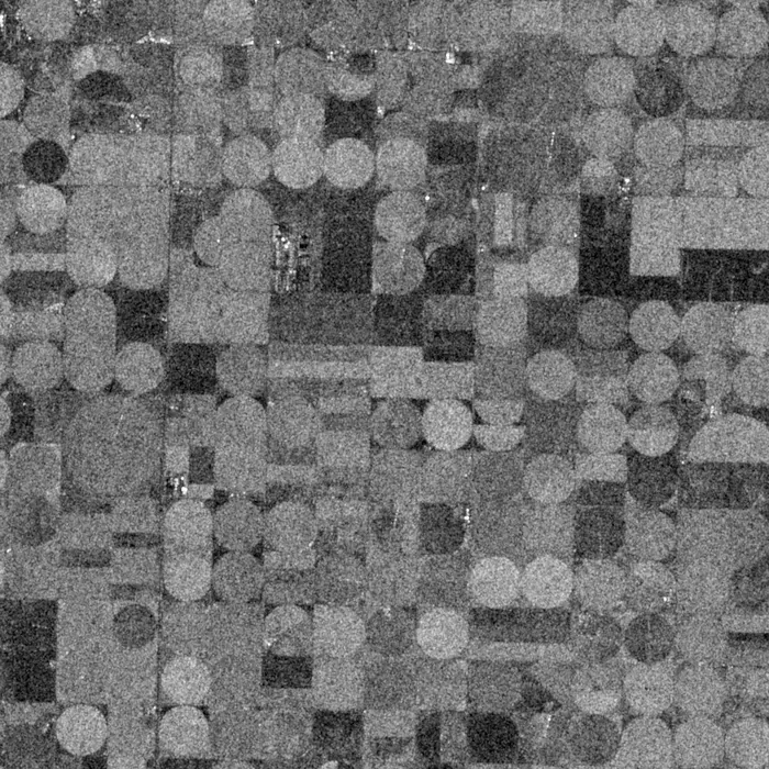
X-band radar (SAR), 3 m and 1 m
Synthetic aperture radar sees through cloud and in the dark. Calm water is black, buildings and steel return bright, and two passes show what moved.
Specification
PH-R payload on the Perihel standard bus, orbit 525 km sun-synchronous.
| Frequency | X-band, 9.65 GHz |
|---|---|
| Imaging modes | StripMap 3 m, Spotlight 1 m |
| Swath width | 30 km StripMap, 6 km Spotlight |
| Polarisation | Single: HH or VV, chosen per tasking |
| Incidence angle | 20° to 45° |
| Noise floor (NESZ) | −22 dB |
| Radiometric accuracy | 1 dB, 3-sigma |
| Revisit, one satellite | 3 days; any light, any weather |
| Daily capacity | Up to 18,000 km² StripMap |
| Antenna | Deployable 3.2 m by 0.5 m phased array |
| Power during acquisition | Peak 600 W, 10 minutes of imaging per orbit |
| Downlink | X-band, 800 Mbit/s |
Products and formats
Every scene is delivered as a cloud-optimised GeoTIFF with a STAC item. Levels are cumulative: you can order L1B and reprocess to L2 later.
| Level | Content | Format | Delivery after downlink |
|---|---|---|---|
| SLC | Single-look complex, phase preserved, slant range | SICD (NITF 2.1), complex int16 | 35 min |
| GRD | Ground-range detected, multi-looked, calibrated backscatter | COG GeoTIFF, float32 | 40 min |
| GEC | Geocoded and terrain corrected, speckle filtered option | COG GeoTIFF | 50 min |
| Change | Coherence and amplitude change between two passes | COG GeoTIFF | 60 min after second pass |
| Masks | Flood extent and ship detections | GeoJSON polygons and points | 45 min |
Example products
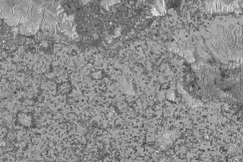
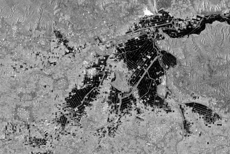
Imagery: Contains modified Copernicus Sentinel data (2023), Sentinel-1 C-band VV, Thessaly, Greece, after Storm Daniel.
Resolution and revisit
Revisit of a mid-latitude point improves with every satellite you add to the plane. See the coverage page for the ground tracks.
| Satellites | Revisit |
|---|---|
| 1 | 72 h |
| 3 | 24 h |
| 6 | 12 h |
| 12 | 6 h |
Typical uses
- Flood mapping
- Open water is dark in radar. A before and after pair gives flood extent through the storm cloud.
- Maritime surveillance
- Ship detection and dark-vessel alerts in open sea, with length estimates.
- Ground motion
- Millimetre-scale subsidence of pipelines, dams and city blocks from repeated passes.
- Infrastructure and mining
- Stockpile change, tailings dam movement and construction progress under cloud.
Sample delivery
Each scene arrives with a STAC item that any STAC client reads. Query it through our API or find it next to the data in your own bucket.
Delivered item, abbreviated
{
  "type": "Feature",
  "stac_version": "1.0.0",
  "id": "PH-RAD-20250728-173012-0412",
  "collection": "perihel-radar-grd",
  "properties": {
"datetime": "2025-07-28T17:52:40Z",
    "perihel:level": "GRD",
    "gsd": 3,
    "sar:frequency_band": "X",
    "sar:polarizations": ["VV"],
    "sar:instrument_mode": "SM",
    "sat:orbit_state": "descending",
    "view:incidence_angle": 34.2
  },
  "assets": {
    "data": { "href": "s3://your-bucket/perihel/perihel-radar-grd/PH-RAD-20250728-173012-0412.tif",
              "type": "image/tiff; application=geotiff; profile=cloud-optimized" },
    "metadata": { "href": "s3://your-bucket/perihel/perihel-radar-grd/PH-RAD-20250728-173012-0412.json" }
  }
}
Questions about radar
Single polarisation keeps the swath at 30 km and the data volume manageable. Dual-polarisation tasking is available on selected satellites on request.
Yes. SLC products keep the phase and are delivered in SICD format, which most interferometry tools read directly.
Heavy rain at X-band attenuates the signal slightly, but clouds, smoke and darkness have no effect. That is why insurers order it on storm days.
Task a radar satellite
Tell us the area and the revisit you need. An engineer replies with orbit, sensor and fee.