Four sensors, one standard bus
Optical, thermal, radar and multispectral payloads fly on the same bus, in the same orbit. Choose the one that answers your question, or fly two on one plane.
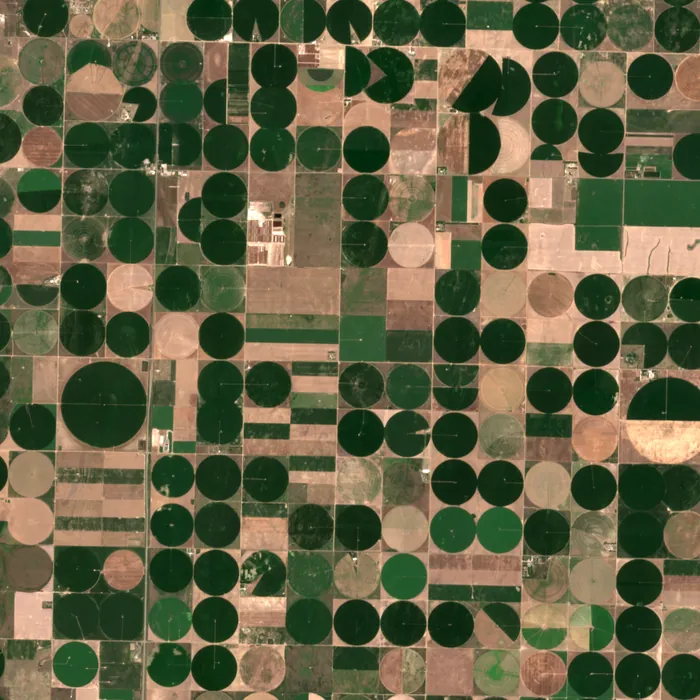
Optical at 0.9 m, natural colour. Imagery: Contains modified Copernicus Sentinel data (2025), Sentinel-2 (10 m example).
Colour imagery for anything a person would recognise from above: new buildings, damaged roofs, full car parks.
| Ground sample distance | 0.9 m panchromatic, 3.6 m colour |
|---|---|
| Swath | 14 km |
| Bands | Panchromatic plus 4 |
| Radiometry | 12 bit |
| Revisit, one satellite | 3 days at ±30° pointing |
| Products | Orthorectified GeoTIFF, surface reflectance, cloud mask |
| Typical uses | Insurance claims, construction, change detection |
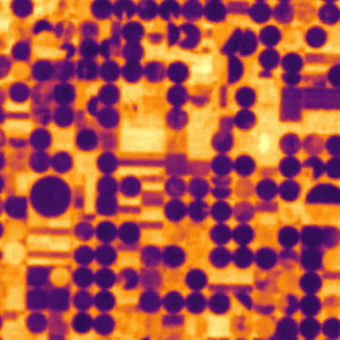
Surface temperature by day or night. Irrigated fields stay cool, and a fire shows up before the smoke does.
| Ground sample distance | 12 m |
|---|---|
| Swath | 22 km |
| Bands | 2 long-wave infrared (10 to 12.5 µm) |
| Accuracy | ±1.5 K absolute, 0.1 K sensitivity |
| Revisit, one satellite | 4 days, day and night |
| Products | Land surface temperature, thermal anomaly mask |
| Typical uses | Heat risk, irrigation, industrial monitoring, wildfire |
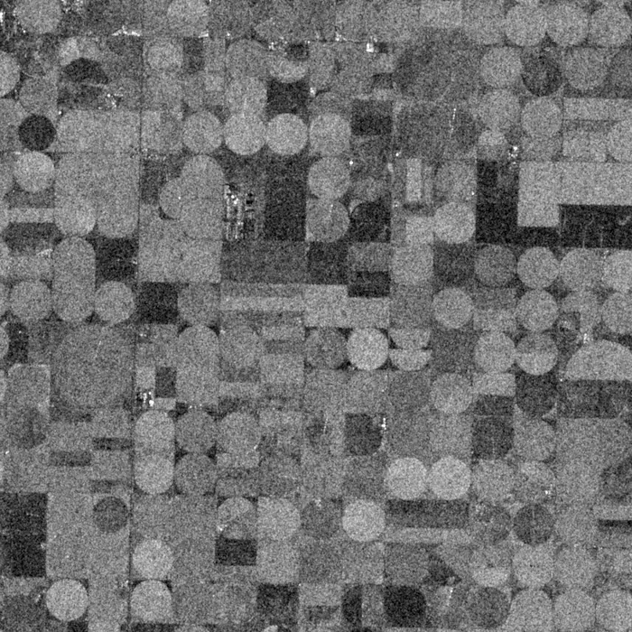
Radar sees through cloud and in the dark. Calm water is black, buildings and steel return bright.
| Ground sample distance | 3 m StripMap, 1 m Spotlight |
|---|---|
| Swath | 30 km StripMap, 6 km Spotlight |
| Band and polarisation | X-band, HH or VV |
| Noise floor | −22 dB |
| Revisit, one satellite | 3 days, any light and weather |
| Products | Calibrated backscatter, flood and ship masks |
| Typical uses | Flood extent, ship detection, ground motion |
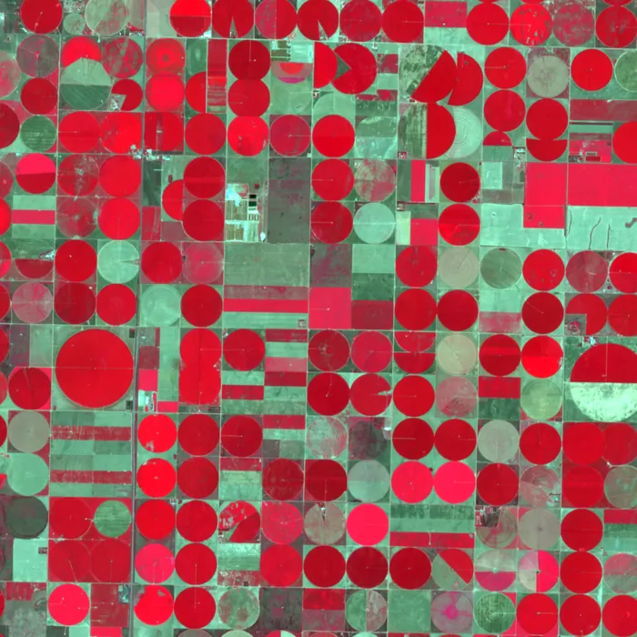
Eight bands from coastal blue to near infrared. Healthy plants turn red; stressed fields fade weeks before the eye can tell.
| Ground sample distance | 5 m |
|---|---|
| Swath | 45 km |
| Bands | 8, coastal blue to near infrared 2 |
| Radiometry | 12 bit |
| Revisit, one satellite | 2 days |
| Products | Surface reflectance, NDVI, NDWI |
| Typical uses | Crop health, forestry, water quality |
All four frames show the same 12 km square of southwest Kansas, 28 July 2025, from public satellite data of that day. They stand in for Perihel products, which have finer resolution than the thermal and radar frames shown here.
Compare the four
Fees are indicative for a single satellite on a three-year term.
| Optical | Thermal | Radar | Multispectral | |
|---|---|---|---|---|
| Resolution | 0.9 m | 12 m | 3 m, 1 m spot | 5 m |
| Swath | 14 km | 22 km | 30 km | 45 km |
| Revisit, one satellite | 3 days | 4 days | 3 days | 2 days |
| Works at night | No | Yes | Yes | No |
| Works through cloud | No | No | Yes | No |
| Fee per satellite, per month | from $38k | from $44k | from $61k | from $41k |
| Mass and power on the bus | 78 kg, 140 W | 64 kg, 110 W | 112 kg, 420 W | 70 kg, 120 W |
Which sensor for which question?
| If you need to know | Start with | Why |
|---|---|---|
| What is on the ground, and has it changed | Optical | Highest detail, easy to interpret, usable as evidence |
| How hot something is, day or night | Thermal | The only sensor that measures surface temperature |
| Where water or ships are, whatever the weather | Radar | Cloud and darkness do not matter |
| How healthy plants and water are | Multispectral | Red-edge and near-infrared bands show change early |
Not sure which payload fits?
Describe the question. We will tell you what the sensors can and cannot answer.